Forums › Western Europe › United Kingdom › Grade Separated Intersections
-
 Stephen Dadda • October 29, 2017 at 9:59 am UTC
I have looked at many Grade Separated Intersections and there is no consistency in the way that the intersections are input in HERE maps. The Grade Separated Intersections I have looked at are on motorways and major trunk roads which are protected roads and were presumably input by or edited by HERE moderators.
My understanding of Grade Separated Intersections is that the roads cross at different heights using a bridge or underpass and there is no direct physical connection between the roads.
When inputting a new roads in HERE maps 3 options are given for specifying the type of connection or junction between 2 crossing roads:
At this crossing the selected road:
Connects to the other road
Is an underpass
Is an overpassI would expect Grade Separated Intersection road crossings to be set as an underpass or overpass depending on the design of the intersection.
On many Grade Separated Intersections some road crossings are shown as underpass or overpass while other road crossings are shown as ‘connects to the other road’ when there is no physical connection.
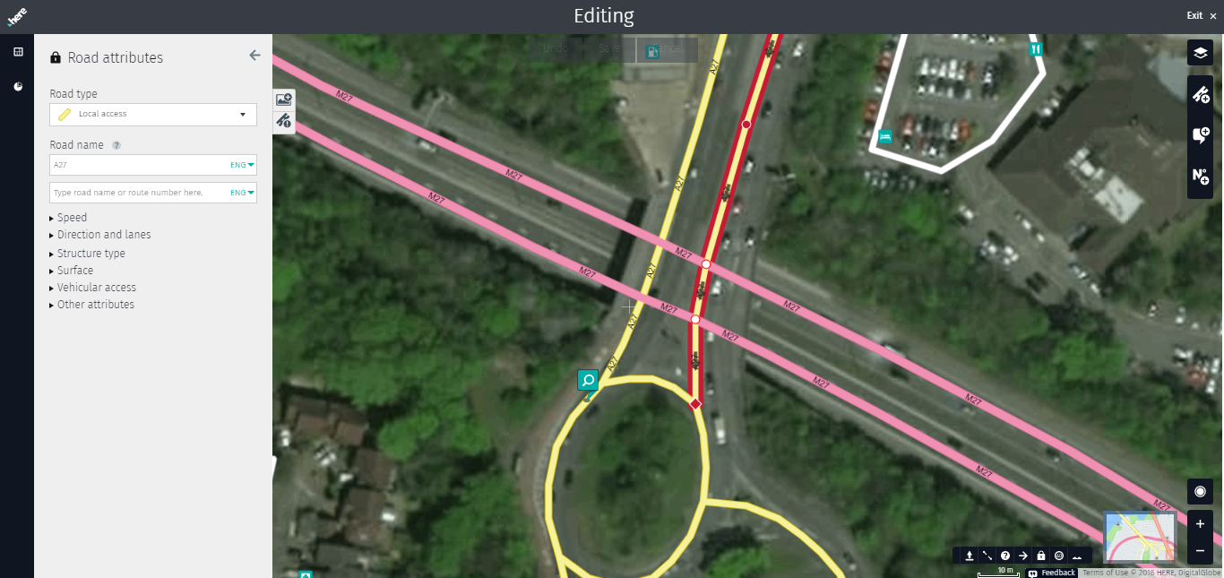
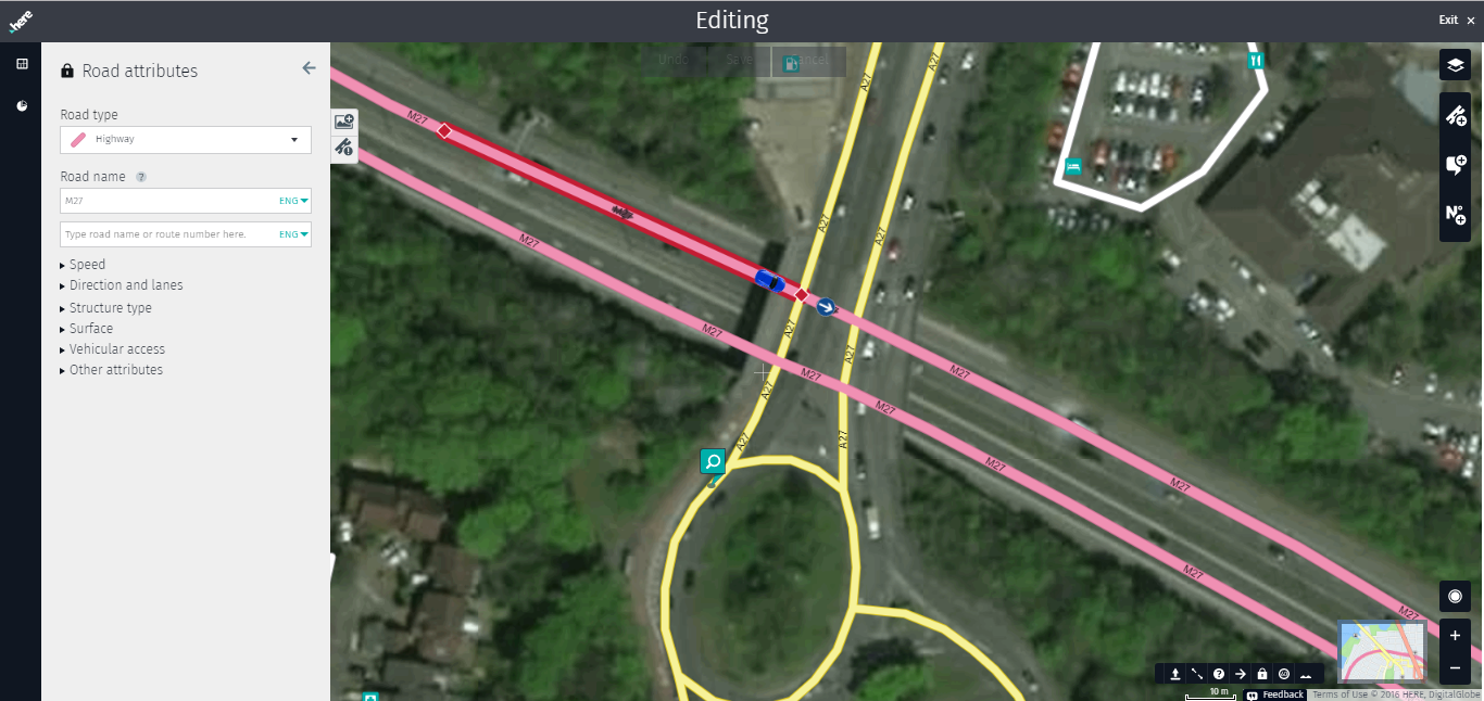
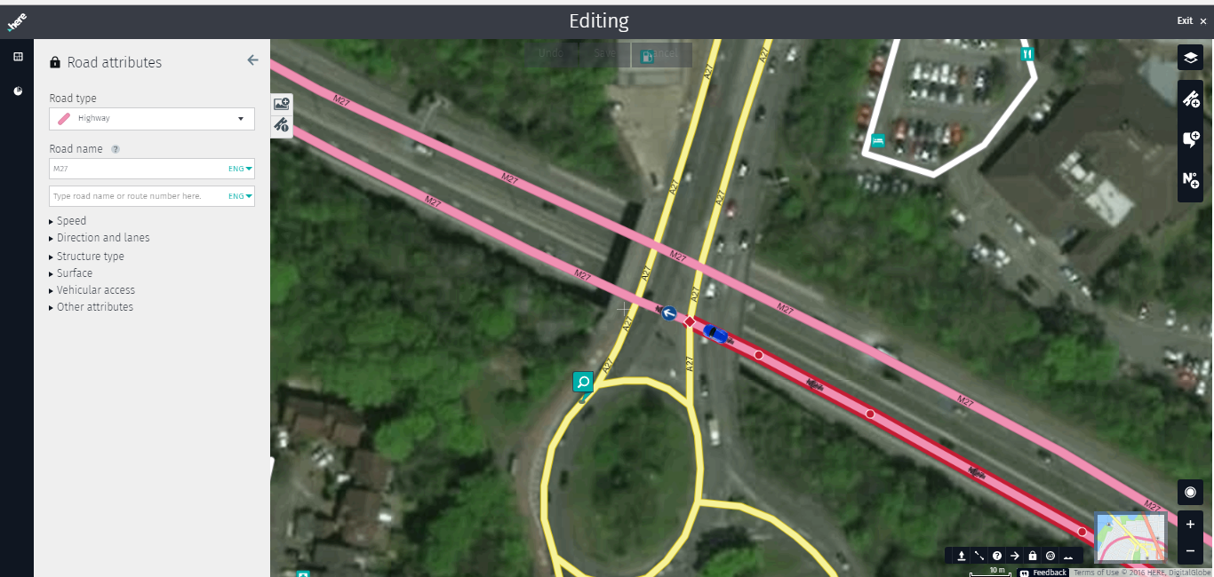
I have attached some screen shots of the M27 and A27 north of the Chilworth Roundabout, Southampton to give examples of the inconsistency in the way road crossings have been input at Grade Separated Intersections. The A27 crosses over the M27 on a bridge. Screen shots were taken at about 09:45am GMT 29/10/2017.
Will you please publish the HERE instructions for inputting Grade Separated Intersections so that those which have been incorrectly input can be identified and reported for correction.
-
This topic was modified 6 years, 9 months ago by Stephen Dadda. Reason: typo correction
Stephen Dadda • December 17, 2017 at 11:02 pm UTCI have just found the HERE videos on YouTube on ‘Adding a Road in HERE Map Creator’ and in particular ‘Part 4 Crossings’.
https://www.youtube.com/watch?v=JfnxXkMsH1U&index=4&list=PLTlZUhyLwZTf57d-pcuuCVzo2pz2Ko3dZ
This video confirms what I suspected that many major UK roads with grade separated or split level junctions and minor and major roads crossing under or over other roads with no physical junction have been incorrectly input into HERE maps.
The junctions are frequently shown as ‘intersects with the other road’ which shows as square at the point the roads cross rather than being correctly input as underpass or overpass which show as a circle at the point the roads cross.
When an incorrect junction type is input the ‘Edit Turn Restriction’ function is used to prevent vehicles being routed via junctions which physically don’t exist.
This presumably slows down route planning calculations as these incorrectly input road crossings have to be checked to see if it is possible to join another road via these non-existent road junctions. There would be further issues if, in the future, traffic priorities at junctions were ever added,.
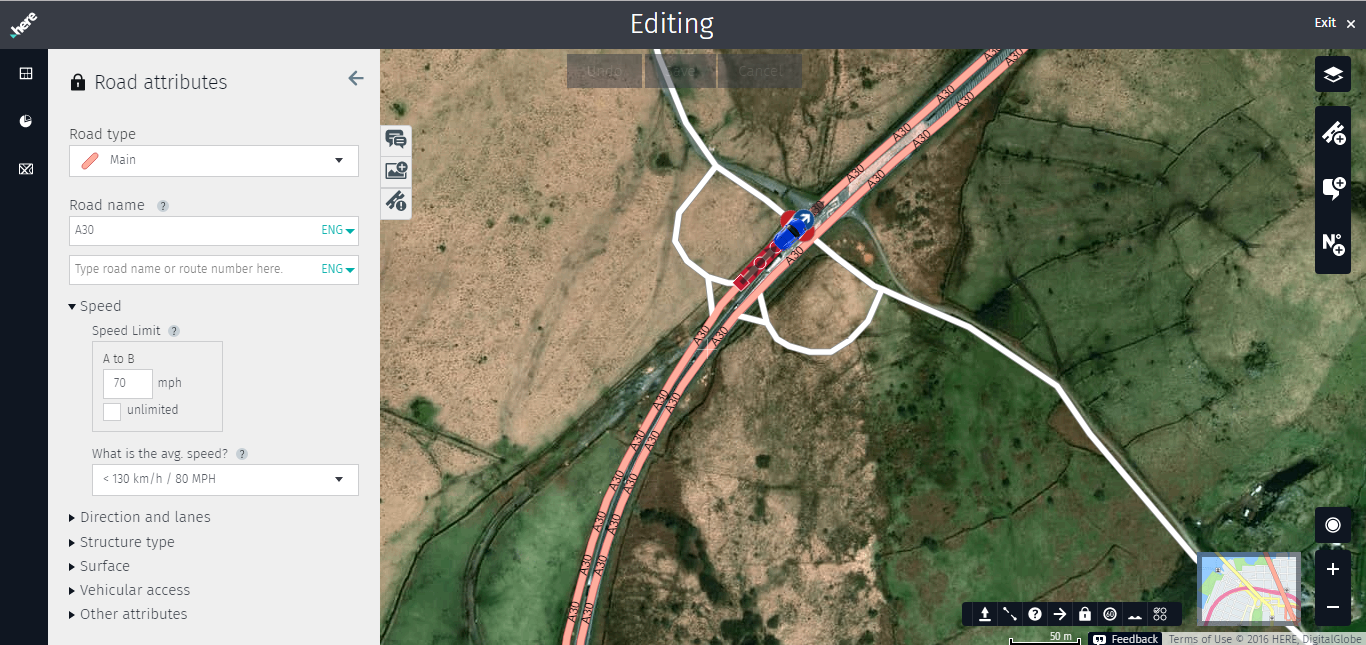
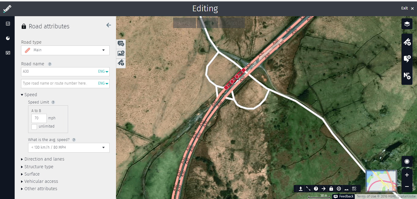
The recently constructed section of dual carriageway on the A30 East of Bodmin was opened in July 2017 and all three new split level or grade separated junctions appear to have been incorrectly input. These are protected roads so I assume the input was done by HERE staff. This shows that it is a very recent and possibly still ongoing occurance rather than a historic legacy issue.
Will you please confirm that this is an issue HERE are already aware of and investigating and resolving or should these incorrectly input road crossings be reported as Map Problems?
The attached screen shots show an example from the Eastern most junction on the new A30 dual carriageway. I have previously reported the out of date satellite images as Map Problems.-
This reply was modified 6 years, 7 months ago by Stephen Dadda. Reason: typo correction
Benjamin Leese • January 4, 2018 at 4:01 pm UTCHi Stephen Dadda,
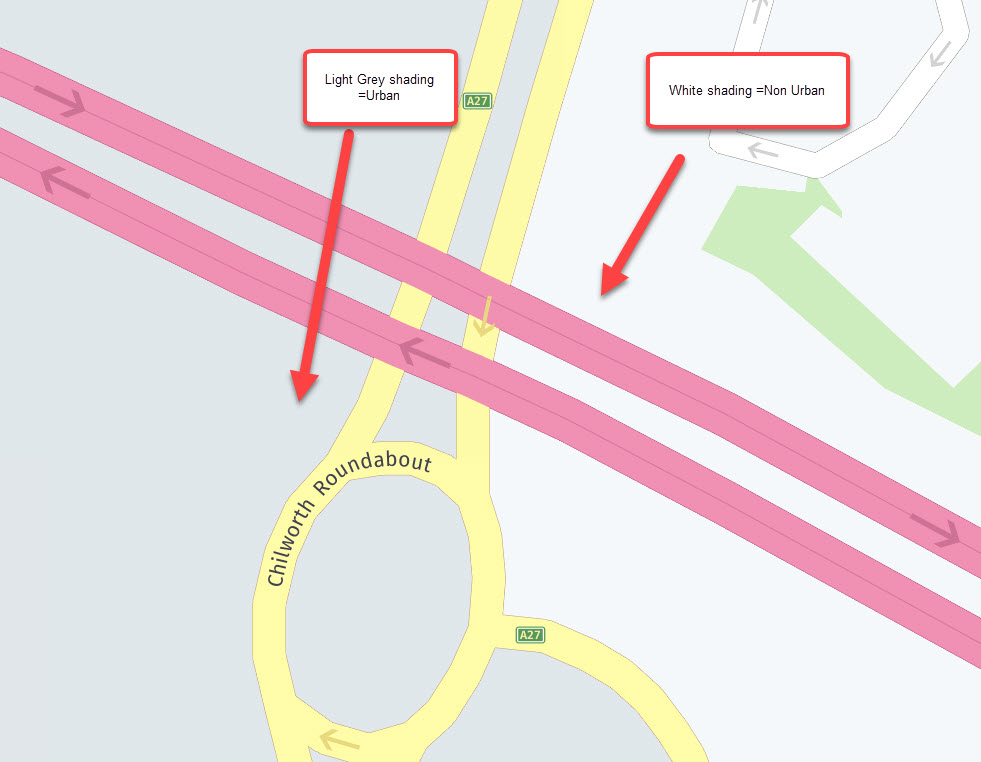
Where a road crosses another in the HERE database a Z-level is created. This is initially a node that will make each section of road separate but its then usually converted into a shape point so that the link is longer instead of smaller chunks (making editing easier for us all!). However nodes will remain when something like a speed limit, administration area or postcode changes at that node.
On the north east bound carriageway of the M27 that you highlighted, the node marks the change from a built up area to non-built up as denoted by grey shading on wego.here.com and therefore cant be changed to a shape point making a longer link.
Please see attachment which demonstrates the colour change and need for the road to be split.
The south west bound M27 simply hadn’t been changed to a shape- it doesn’t affect the database in reality just makes it easier to edit.
I hope that makes sense.
Thanks
Ben
Benjamin Leese • January 4, 2018 at 4:30 pm UTCHi again Sephen,
Ref the second post you made.
I’ve asked the software development people to take a look at the wording of the pop up in Map Creator when creating crossing junctions to see if it needs clarification.
In relation to the A30 dualling scheme i was the ‘HERE Professional’ that added it to the database. HERE professionals use a separate in-house GIS software program that as you’d expect has a much bigger toolset and access to more recent imagery (due to licensing reasons these images cant always be made publicly available until a certain time). Adding a new bridge over a dual carriageway is carried out by a different method that has been quality checked over many years.
The three new junctions are all roads crossing above the A30 at Z level +1. Some have node splits as mentioned earlier, for reasons such as when climbing lanes start on the A30 or the administration area changes (here it logically makes sense to reuse a node in open countryside with no clear boundary).
Thanks again for your inputs.
Ben
-
This topic was modified 6 years, 9 months ago by

You must be logged in to reply to this topic.