Forums › Western Europe › United Kingdom › A489, Newtown
-
 Richard Jones • July 10, 2018 at 10:36 pm UTC
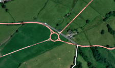
This road (the straight A489) needs to be removed as it’s now been replaced by the roundabout.
https://mapcreator.here.com/mapcreator/52.502214156265325,-3.351978535995471,17,0,0
I now have accurate maps for the Newtown bypass so will draw in the correct route and its various junctions and roundabouts.
 Gordon HERE Map Master (Ambassador) • July 10, 2018 at 11:28 pm UTC
looking at latest satellite imagery it looks like the roundabout is still under construction and not an active road yet,. so until proof is received the road is open the other road cannot be removed
 Ben (HERE Moderator) • July 11, 2018 at 10:03 am UTC
Hi Richard
Thanks for highlighting this. I can see HERE probe data from the past 24 hours showing that the new roundabout is in use. I will remove the former A489 road to the north of the roundabout. Do you know if any of the old road remains to access the farm located on the road? It’s not clear on the probe data due to construction traffic.
I’ve also added the roundabout on the south eastern side of Newtown close to Wern Ddu Lane.
Thanks
Ben
 Richard Jones • July 15, 2018 at 10:57 pm UTC
I’ll need to draw it after having looked at my dashcam footage. The junction at the eastern end https://mapcreator.here.com/mapcreator/52.521078087403765,-3.280889268264758,17,0,0 is rather complicated as it involves a dive-under. The road system as I’ve drawn it in the above link is *correct* as it’s drawn from my GPX files and from visual surveys of the work in progress. (I pass this way weekly.)
 Richard Jones • July 16, 2018 at 7:41 am UTC
For info, this the highest-res map of the route that I’ve so far found:
https://community.alungriffiths.co.uk/wp-content/uploads/sites/2/2016/02/Newtown-Scheme-layout.png
 Richard Jones • July 16, 2018 at 11:48 am UTC
New roundabouts drawn, and access roads by the western roundabout drawn.
 Richard Jones • July 17, 2018 at 2:47 pm UTC
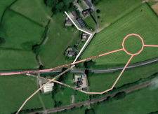
Could someone please lock the eastern roundabout – someone has drawn in new roads which haven’t been built or opened to the public yet, and won’t open until the bypass itself opens later this year. I’ve just reverted it to its current physical layout. The image is the current physical layout, and this is the outline map:
https://community.alungriffiths.co.uk/wp-content/uploads/sites/2/2016/02/Newtown-Scheme-layout.png
This is the area in question:
https://mapcreator.here.com/mapcreator/52.52052645359126,-3.282021160469043,18,0,0 Ben (HERE Moderator) • July 17, 2018 at 4:11 pm UTC
Hi Richard
I made the edits in this area whilst endorsing the changes you’ve made. However i’m also adding a construction status on them so that routing wont occur over them. This is should as dashed lines on wego.here.com but solid on map creator.
Sorry for any confusion!
Ben
 Richard Jones • July 18, 2018 at 7:50 pm UTC
Thanks – so I see, but I’ve had to re-draw the A483/A489 Kerry road roundabout as it was again deleted. This roundabout is live – only the two Dolfor Road roundabouts are yet to be constructed (and therefore not in use) but the other three on the bypass route have been built and are open to all traffic. I’ll be taking a look tomorrow afternoon, with GPX recording.
The A489 goes around the roundabout from NW to SE, and is connected to it, and is thus open to traffic in this configuration. The A483 going diagonally opposite is under construction.
Keep an eye on this website for the current state of construction:
 Richard Jones • October 11, 2018 at 10:57 am UTC
There’s a separate issue I need to raise about the A483 Llandrindod Wells road just south of Newtown, Powys. The road layout has changed significantly because the northernmost of the two roundabouts here has now opened. I can’t change the road geometry because it’s locked. Someone at Here.com will need to draw it from my recorded GPX file.
This is how I’ve drawn it on OSM from my GPX:
 Ben (HERE Moderator) • November 12, 2018 at 3:13 pm UTC
Hi Richard
I forgot to say i followed up on this and added the change to roundabouts.
I understand that the new road opens around late January/early February 2019. That means I’ve changed the function classes of the roads to reflect the final layout when opening but routing wont occur on the new road until its ready. This should appear soon on wego.here.com and can be seen on map creator now.Thanks
Ben Richard Jones • February 16, 2019 at 10:45 am UTC
Hi Ben,
The bypass opened on Thursday 14th February 2019. I drove it on that day to gather gpx, and have now redrawn various sections of the map from my tracks. Please don’t revert it to its previous state, as it was incorrect. The speed limits are the bext thing I need to amend on the map, after I go through my dashcam videos.
Richard
 Ben (HERE Moderator) • February 19, 2019 at 5:20 pm UTC
Hi Richard,
You must be pleased this has finally opened. Your inputs are greatly appreciated as the newest aerial images that i can access are from May 2016 which show none of the scheme under construction. The Welsh Government provided a speed limit traffic order last week which i used to update the speed limits.
In the next month or so our TRUE cars will be out on the road again as the daylight and weather improves. They are scheduled to collect data of the new bypass to ADAS standards (such as inclines, widths and Lidar point clouds)
Thanks, Ben Richard Jones • February 19, 2019 at 6:50 pm UTC
Thanks Ben. That’ll save me doing it. Have you got the details of the speed limit downgrades around the A489/A470 junction at Caersws, then from Caersws north to Clatter?
Richard
-
This reply was modified 5 years, 2 months ago by
 Richard Jones. Reason: Name
 Richard Jones • February 24, 2019 at 9:50 pm UTC
Ben,
I took a look at the Here app today, and noticed several alerts in a couple of my adopted neighbourhoods for the Newtown bypass. I see that a “HERE Professional Vikashchandra Mishra” had modified the route of the bypass, and modified (and deleted) roads joining it. I’ve just spent 30 mins redrawing and redoing the errors he’d introduced – what were long-radius curves in one direction suddenly had S-bends in the middle of them. I’ve had to iron them out, following my GPX traces (which Vikashchandra Mishra seems to have ignored).
Richard
-
This reply was modified 5 years, 2 months ago by
You must be logged in to reply to this topic.

