-
 John Perry • November 1, 2020 at 9:34 am UTC
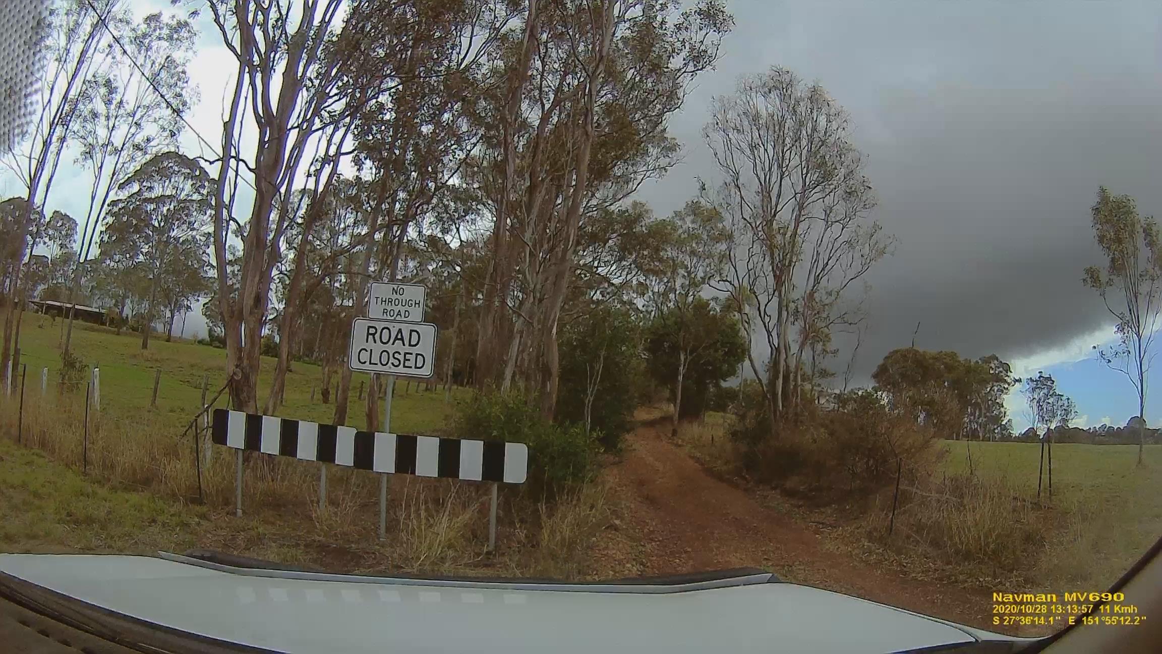
even with photos uploaded to the map they still can not read the road is closed? and put the road back?
John Perry • November 1, 2020 at 9:36 am UTCLooks like a road closed to me even has the gps on it and date???????????????
John Manning • November 1, 2020 at 9:46 am UTCJohn., have you seen what happened with your submission? I’m wondering if it was rejected or just hasn’t been processed yet?
BTW, it’s refreshing to see something posted here that isn’t spam 😉
John Perry • November 1, 2020 at 10:43 am UTCi took the road off that is closed and now it’s back again. don’t know how to work out if they even looked at it.. another edit i did the same day is still there. so don’t know. can not see why it would be rejected, with the photo there as well.. they just keep taking the edits off even with the photos uploaded dated and with gps on them same as above. wasted another 5 hours today fixing speeds up… see what happens to them before i do anymore. they go i’ll just give up. does this look made up? speed sign. pic. already fixed it once and all edits where taken off. now the pic’s are uploaded to so see what happens
John Perry • November 1, 2020 at 10:45 am UTCwhy don’t they delete the spam and block the people????
John Manning • November 1, 2020 at 11:49 am UTCIn the browser version of MapCreator, you can look at the “Your Stuff” menu down the left and within that, the “Your Feed” option. Once there you can see your submissions for Places, Road, House Numbers, etc.
I had a look under Places and see that most of mine are listed as “Under Review”. I had to go back to February to find one that was “Resolved”.
I don’t check there much myself but it looks like nothing much is happening with recent changes. Even going back a couple of years, most submissions are not resolved. Make you wonder…
Kevin Hutchison • November 1, 2020 at 9:50 pm UTCYes I have found similar looking at the My Stuff list I guess resources are limited at present.
John the photo you attached in spit of the sign shows a dirt road is that servicing one house or does that connect the two parts of Frew Street.
I had a similar issue with a street cut in half and in the end I made the missing bit a non trafficable trail, even though there was no connection. I have another where no matter how often I remove it it keeps coming back planning to submit a GOPRO video of the street ASAP.
John Perry • November 2, 2020 at 6:10 am UTCI didn’t drive past the road closed sign… thats 3 Demerit points for doing that. i/ll have to go to the other side and have a look. but as the sign has on it road closed…
Kevin Hutchison • November 2, 2020 at 9:17 pm UTCI have obtained access to our councils Mimaps cadaster system that shows the subdivisions and property boundaries in our area and I see how some of the roads get put in as they are planned but not yet formed. Three would be a similar thing in every council only a question of finding it the gaining access, often local SES have access.
We requires an option in Map Creator to allow a road to be planned but not yet made as there are thousands even the new highway changes could then not get confused until actually open to traffic.
Kevin Hutchison • November 2, 2020 at 10:02 pm UTCThe Queensland mapping system QTopo has the street going through, my Garmin shows half unsealed but Google Earth makes it look like it is a through gravel road with a dirt track joining the two sections. My guess is that the residents complained to council that people following their GPS were driving up their drive hence the road closed sign.
I have made the centre section a non trafficable trail lets see if that passes.

You must be logged in to reply to this topic.