Forums › Eastern Europe › Lithuania › Map Creator tricks
-
 Ingrid HERE • August 11, 2017 at 12:41 pm UTC
There are some useful features in Map Creator, that make the mapping easier.
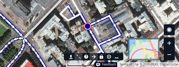
One of these are the “highlight” buttons in the bottom right corner. These can be used to display roads, based on pavement, speed limit or direction of travel. Another helpful button is “highlight missing connections” which draws attention to a road not connected to another. The latter can be combined with highlight options.
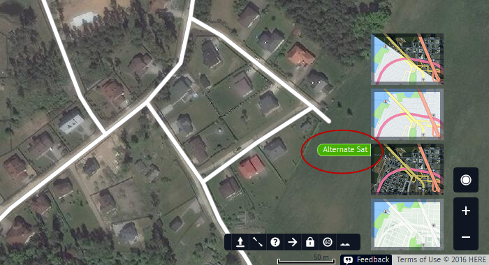
Happy mapping! Ingrid HERE • September 4, 2017 at 9:50 am UTCThere is a possibility to switch between two satellite imageries in Map Creator. Clicking on the “map view” in the bottom right corner reveals four different map displays. Next to the imagery option you will see a small tab “Alternate Sat”. Clicking on that will change the default imagery.
Ingrid HERE • October 23, 2017 at 2:43 pm UTCWhile editing, it is possible to change the transparency of the roads layer. Use these combinations: Ctrl+Alt+”+” ja Ctrl+Alt+”-” and you will be able to take a peek at the underlying aerial imagery 🙂
Anton Vass • April 30, 2021 at 5:37 pm UTChttps://www.youtube.com/watch?v=dLcMcdbb4Ho
look at this! That do you think?
ava james • March 24, 2023 at 10:37 am UTCI am glad to see it thanks for sharing this. check this lightinthebox discount code
idf sdse • September 19, 2023 at 5:40 am UTCincreasing YouTube watch time brings a multitude of benefits, including improved search rankings, increased ad revenue, enhanced viewer interaction, and long-term channel sustainability. By focusing on creating engaging content that captivates your audience, you can unlock the potential of watch time and take your YouTube channel to new heights. See more detail https://sthint.com/2023/09/16/how-to-get-free-facebook-page-likes/
Andy Walker • May 27, 2024 at 8:33 pm UTCVery informative and well-articulated. This article does a fantastic job of breaking down the topic into manageable sections, making it accessible to a broad audience. Keep up the great work!OlympicGamesParis
Ania Queen • May 27, 2024 at 9:21 pm UTCMeskipun banyak hal positif yang dapat ditemukan dalam FANTASITOTO , penting bagi pemain untuk tetap bermain dengan bijak. Mengingat bahwa ini adalah permainan yang melibatkan uang, pengelolaan keuangan yang baik serta kesadaran akan batasan diri adalah kunci untuk menikmati permainan tanpa menimbulkan masalah finansial.
You must be logged in to reply to this topic.