-
 José Flor – OzFlor • May 10, 2018 at 12:53 am UTC
Hi,
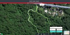
When I try to draw trails over mapillary layer most of the time it opens the image corespondent to where I click. I can deactivate mapillary layer but still very hard to draw.
Can the mapcreator programmers deactivate the images from opening when the ADD ROAD IS ACTIVE? That would be a great tool.
Note, I use ?scope=mpc to moderate in Portugal, not in Australia nor in Thailand.Regards
José Flor – OzFlorhttps://mapcreator.here.com/mapcreator/-34.399140371044865,150.86213032436376,18,0,0?scope=mpc
 Bernice Stalley • May 14, 2018 at 4:51 am UTC
Hi José Flor – OzFlor,
Ill pass on your request. I can understand how that would be difficult. Alternatively, you can collect GPS for any new roads/trails and load into Map Creator.
Thanks,
Bernice José Flor – OzFlor • May 14, 2018 at 5:08 am UTC
Hi Bernice,
Thank your your replay.
Ii have a question. I do a lot of mapilarry and upload that to the mapillary. How would I collect GPS and upload to mapcreator? Once I do that, can I edit the mapcreator using that GPS visible to me? In this case, wile i colect mapillary can I aslo colect GPS for mapcreators?
Regards
José Flor – OzFlor José Flor – OzFlor • May 14, 2018 at 11:39 am UTC
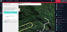
You mean this GPX?
I go download mapcreator for mobile now and look into that.
You must be logged in to reply to this topic.

