Forums › Western Europe › Netherlands, The › Bug
-
 Martijn W • August 5, 2021 at 5:35 pm UTC
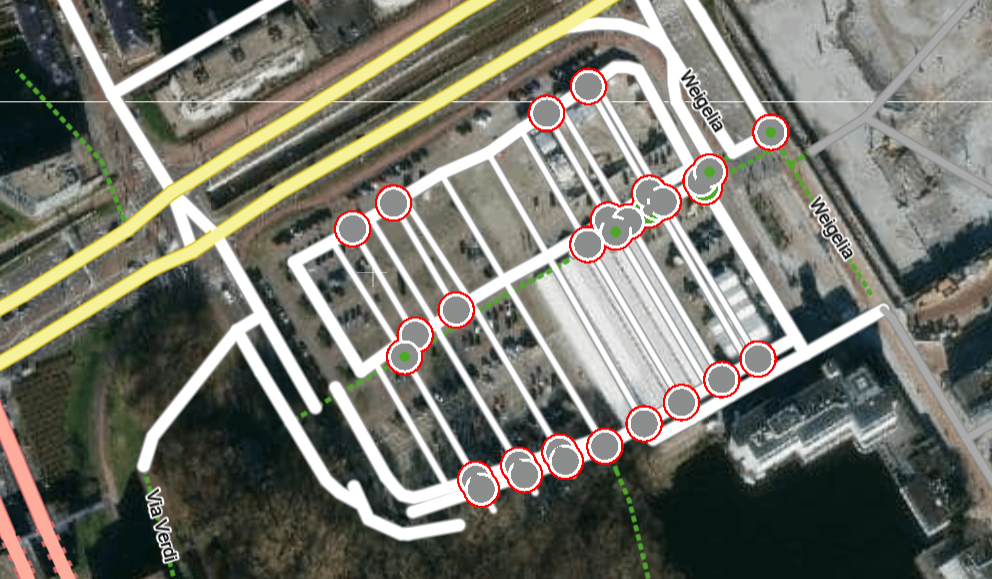
The famous bridge is back. All roads in this area are mixed up. Some have even disappeared.
Martijn W • August 5, 2021 at 5:36 pm UTCsee Appendix
Eric Oeder • August 6, 2021 at 9:12 am UTCHello Martijn,
work in the Core Map is in progress, that´s why the confusing situation in this area in MC.
Please don´t edit at that location anymore to avoid a longer process.
Let me know in about 2 weeks if the area will look better then in MC.Thanks, Eric
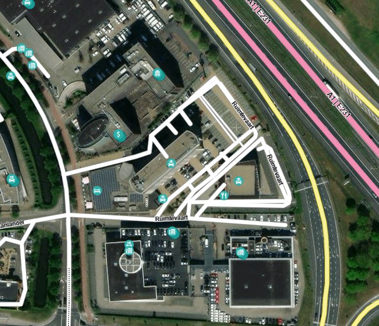
Martijn W • August 8, 2021 at 5:10 pm UTCHello Eric, more then 2 weeks ago I edit the roads of the street ‘Ruimtevaart’ at the city Amersfoort. But stil the roads are mixed up.
Eric Oeder • August 9, 2021 at 12:17 pm UTCHi Martijn,
if you check the status of your edits you will notice that the process is ongoing. So please don´t change it again. Martijn W • August 21, 2021 at 4:52 pm UTC@Eric,
Around The Mall of The Netherlands in Leidschendam it looks better, but it’s stil not how it should be. Also around the street Ruimtevaart it’s stil a mess.
Other issues: I was lokking around in the city Amersfoort at some places roads have been cut or there’re double roads overlapping each other:
– Ringweg-Koppel/Kattenbroekerweg
– Kapelweg/Ceramstraat
– Timorstraat/Leusderweg
– a parking lot near the Vening Meineszstraat
– Barchman Wuytierslaan
– A28 near exit 6 Eric Oeder • August 23, 2021 at 9:24 am UTCAs said, please always check first the status of the changes. If there is still ongoing work then please don´t change anything again as this might lead to further delays.
Martijn W • August 24, 2021 at 1:41 pm UTC@ERIC
“As said, please always check first the status of the changes”
I know, but I made hundreds of edits. So, the list is very long. It’s almost impossible to find the correct edit in the list.
Eric Oeder • August 24, 2021 at 3:00 pm UTCyou can also check in the map itself, below the attribute table after clicking on the relevant link. Then the color legend opens where you can see what means which color. Highest status would be “integrated”.
Martijn W • August 24, 2021 at 8:16 pm UTCGreat! I didn’t know that. So, if I understand correctly. When a road or POI is grey. You can edit it. If it’s yellow, just wait.
You must be logged in to reply to this topic.