Viewing 2 posts - 1 through 2 (of 2 total)
You must be logged in to reply to this topic.
Forums › Western Europe › United Kingdom › Vineyard Path, Mortlake, London
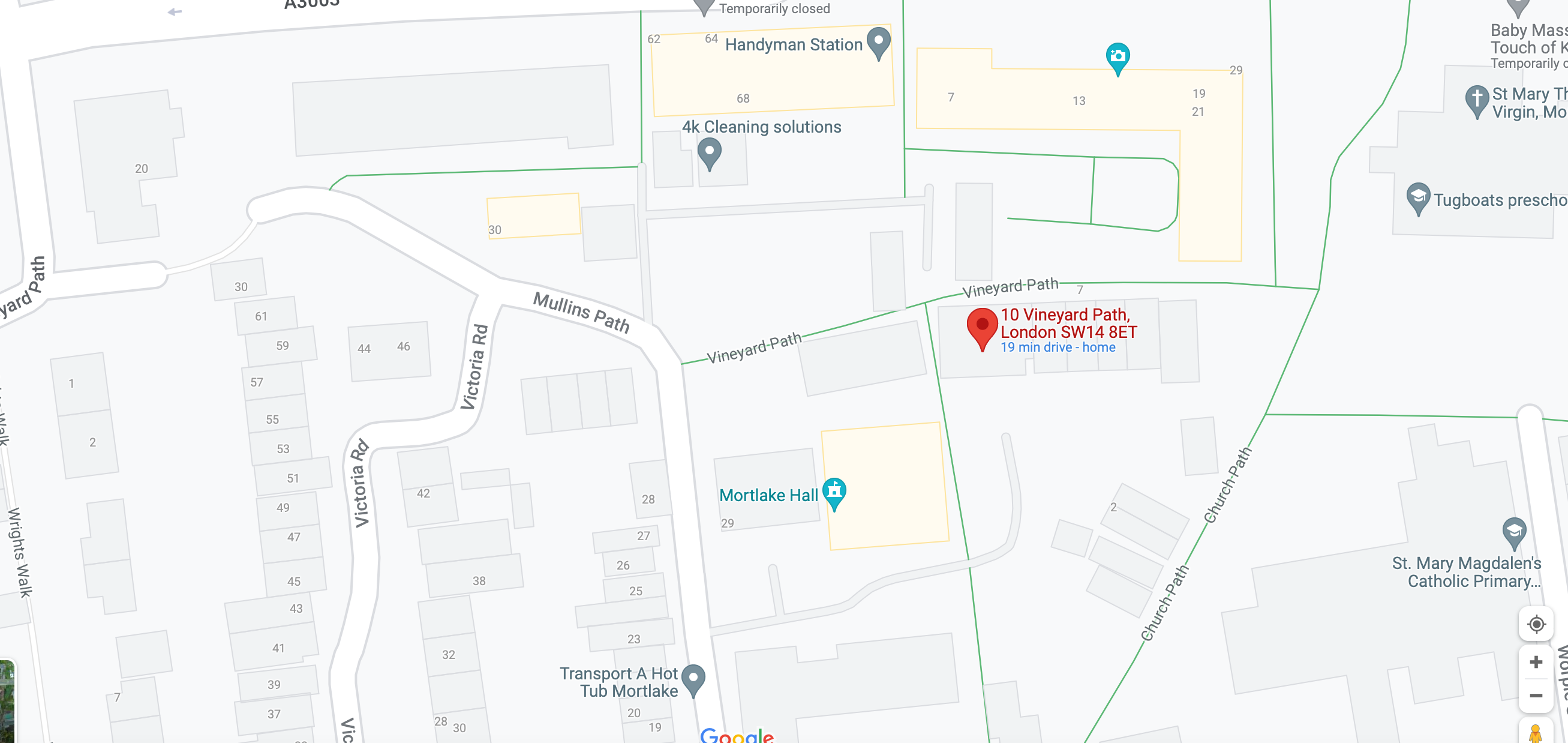
Vineyard Path, SW14 London, is a split road separated by a building. One half is a road, the other half a pedestrian route. SW14 8ET is the postcode for 10 Vineyard Path, an apartment block on the pedestrian section, however, GPS incorrectly shows 10 Vineyard Path as 8 or 14 Vineyard Path, on the road portion. I have been able to report this via Google, but still have drivers unable to find the block of flats. I have just joined this forum in the hopes that someone with the skills I do not have will be able to make this map change. I have attached the google map of the area showing where 10 Vineyard Path is actually located. Can anyone help make this correction?
Hi Nola,
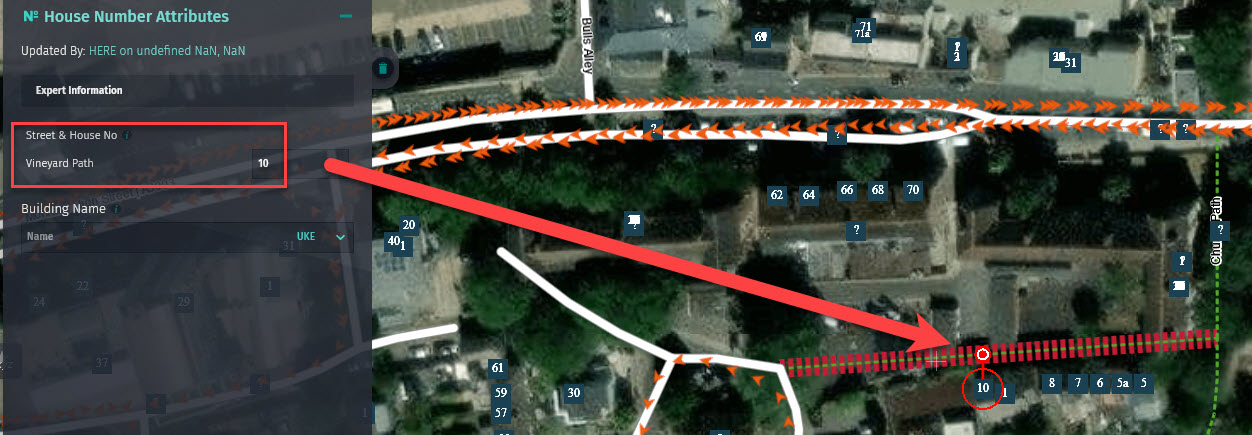
Upon checking the HERE database, the section of Vineyard Path that is a walkway, between Church Path and Mullins Path, is where the address number 10 is already located. This matches what you report above.
Thanks, Ben
You must be logged in to reply to this topic.