Forums › Western Europe › Belgium › Prins Albertlaan (N43) – draw as separate lanes
-
 Thomas De Rocker • January 24, 2019 at 12:49 pm UTC
Both lanes of the Prins Albertlaan are separated by tram tracks (From R40 to Maria Hendrikaplein). I tried to redraw them as 2 separate one way roads, which corresponds better to reality. See waze maps and latest satellite pictures as reference.
https://www.geopunt.be/kaart?viewer_url=https%3A%2F%2Fmaps.geopunt.be%2Fresources%2Fapps%2FGeopunt-kaart_app%2Findex.html%3Fid%3D8ab252d76835629801687fe7689300f1Again, my edits are reverted, resulting in a completely incorrect situation! (One of the oneway roads is still there, the other is removed, so traffic is incorrectly restricted!)
Map Creator Benelux • January 28, 2019 at 2:05 pm UTCHi Thomas,
Thank you for your feedback. It’s a pity your edits were reverted again…I reported this issue and I’ll keep you posted when it’s solved. Thank you again!
Greetings,
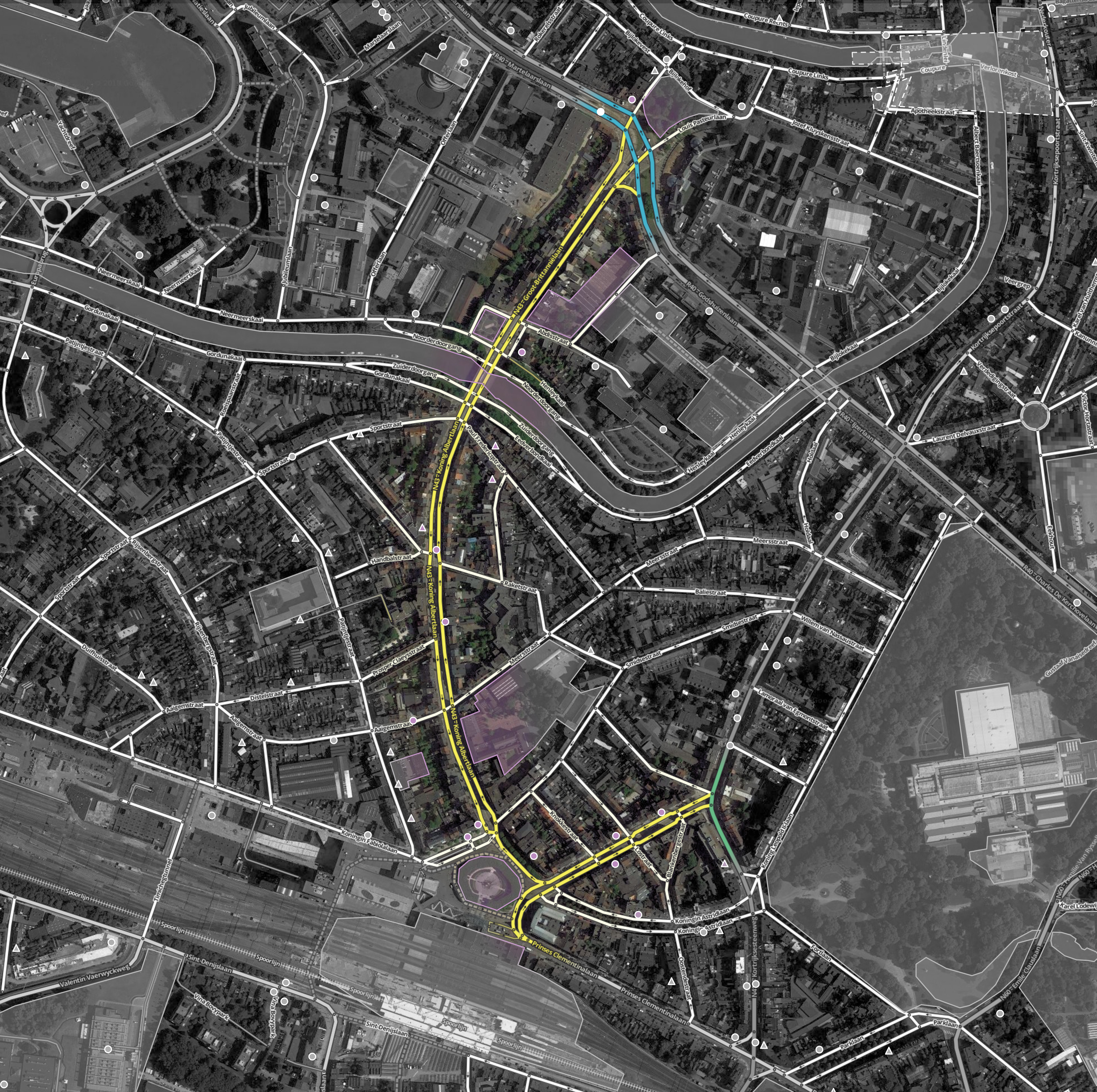
Alicja Thomas De Rocker • February 5, 2019 at 10:01 am UTCSee attached image (yellow colored roads) for more information of how the situation should be. I won’t edit it myself again, to prevent further map errors.
The screenshot is based on the waze map info (image is about 4000×4000 pixels, so zooming in should help!)Thanks in advance!
Map Creator Benelux • February 11, 2019 at 8:55 am UTCDear Thomas,
Thank you. I added this information to have it checked, so I’ll keep you posted about the status. Greetings, Alicja Map Creator Benelux • February 19, 2019 at 8:54 am UTCDear Thomas,
Your feedback is being checked and processed into our core map. Thank you.
Greetings, Alicja
You must be logged in to reply to this topic.