Forums › Western Europe › Germany › Closed road
-
 Konstantin Soyka • November 13, 2017 at 1:02 pm UTC
This section of the street has been closed many years ago and became part of the property in the "triangle" of Lindenstraße; L42, Wiesenweg & this closed road.
Today the remaining functional junction is Lindenstraße; L42 with Wiesenweg. Eric Oeder • November 13, 2017 at 4:52 pm UTCHi Konstantin,
thanks for the information.
I will forward this to our Core Map Team that perform the necessary coding changes accordingly. Keep you informed when I will get further info.Best regards
Eric Eric Oeder • December 18, 2017 at 7:55 am UTCHi Konstantin,
should be solved now.
Thanks and kind regards
Eric Konstantin Soyka • May 14, 2018 at 6:33 am UTCHi Eric,
what’s the status for this issue?
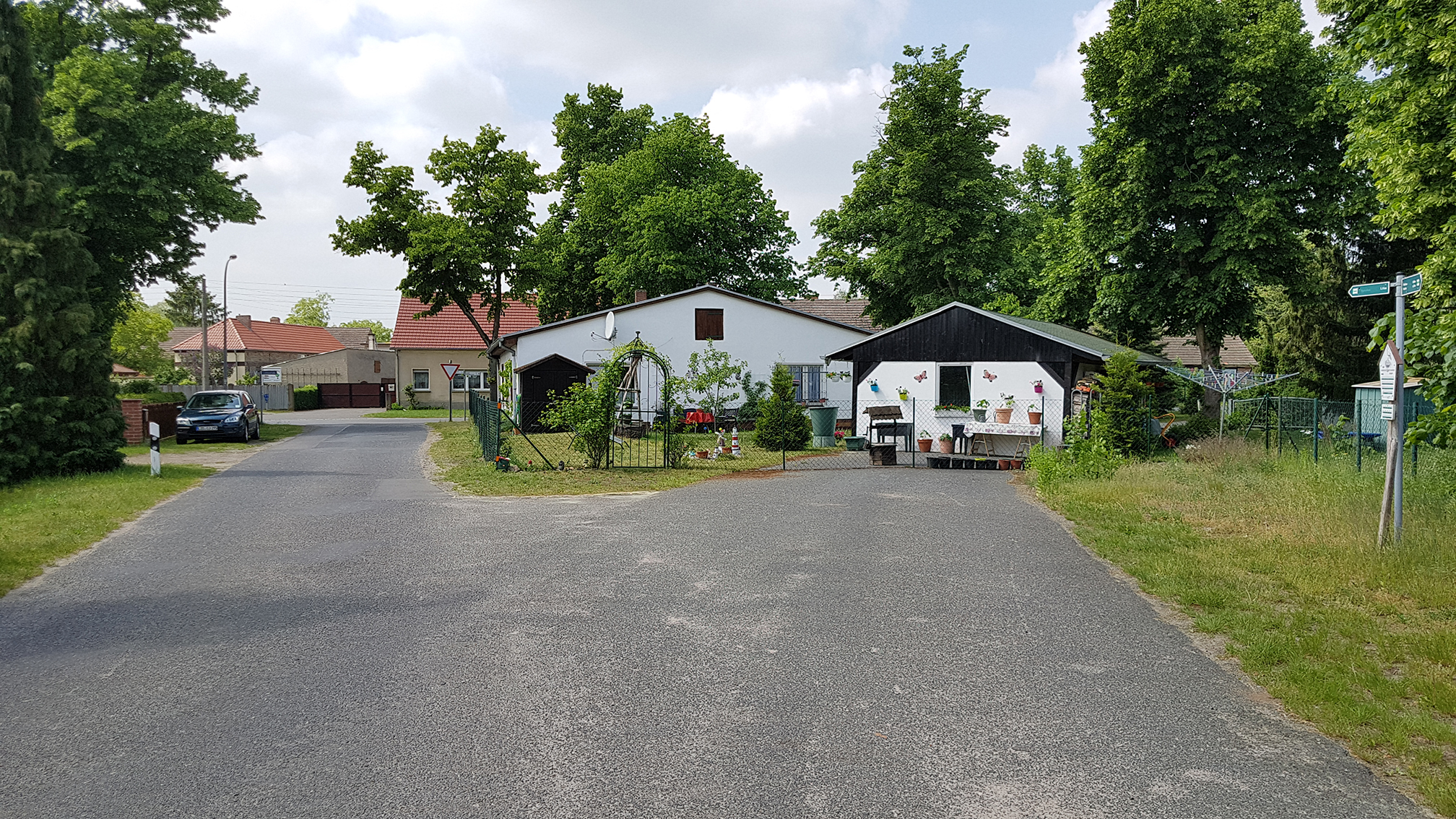
As of today I can still see the closed road section in MapCreator and wego.here.com.
I attached a photo that I took this weekend. You can see that on the closed road (right one) there is now a small building.Thanks,
Konstantin Bernd Gehle • May 14, 2018 at 10:32 am UTCHi Konstantin
In MapCreator it`s all right now
Best regards –
Bernd-
This reply was modified 5 years, 11 months ago by Bernd Gehle.
Konstantin Soyka • June 1, 2018 at 7:25 am UTCHey guys,
the fix has been reverted again?? I can again the complete segemnt in MapCreator.
Is there a conflicting other data source that is always overwriting the change of MapCreator?
Then it should be fixed there, too. Eric Oeder • June 1, 2018 at 10:57 am UTCHi Konstantin,
please have a look to the Access Characteristics (in MC “Vehicular Access”). The link is open for “No Through Traffic”.
If you think the link should be disconnected at the NW side please go ahead and do so.Best regards
Eric Konstantin Soyka • June 1, 2018 at 10:58 am UTCYou can clearly see in the photo I attached to this thread that the street is closed. It’s not even open for pedestrians. There is a building on the street surrounded by a fence. It’s private ground. The street link should be removed completely. It’s also not relevant for pedestrian routing.
Eric Oeder • June 1, 2018 at 12:14 pm UTCHi,
I mad some changes. Please check for housenumbers now. The house visible on the picture has number 6 or is it an additional number? If so please add that one.BR, Eric
Konstantin Soyka • June 1, 2018 at 12:25 pm UTCThx for the fix!
Housenumbers are correct. Attached a screenshot of geoportal Brandenburg which indicates private ground, houses & house numbers.
-
This reply was modified 5 years, 11 months ago by

You must be logged in to reply to this topic.