Viewing 2 posts - 1 through 2 (of 2 total)
You must be logged in to reply to this topic.
Forums › Western Europe › Netherlands, The › Add PDOK Aerial Photos as a alternative satelite layer
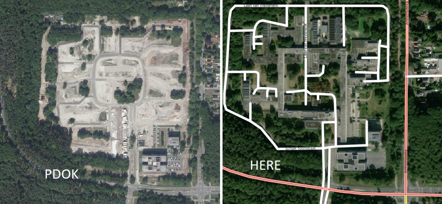
It would be nice to have the PDOK aerial photos as a background layer.
They provide a free yearly updated aerial pictures layer (Actueel_ortho25) (TMS, WMTS).
Would make it a lot easier to draw in new roads :).
WMTS Service:
https://geodata.nationaalgeoregister.nl/luchtfoto/rgb/wmts?request=GetCapabilities&service=wmts
Hi Gerben,
Thank you for your message and the idea! Let me investigate it.
Greetings,
Alicja
You must be logged in to reply to this topic.