Forums › Western Europe › United Kingdom › A1270 Broadland Northway
-
 Jim Hamshaw • February 6, 2019 at 5:27 pm UTC
I've tried many times to "upgrade" the western sections of this road from "local" to "main". This is a brand-new dual carriageway from end to end fully opened in 2018. It as a UK national speed limit of 70mph. Can someone at Here please ensure that the changes "stick"?
Jim Hamshaw • February 26, 2019 at 9:41 am UTCStill keeps changing back to “local”……
Jim Hamshaw • February 28, 2019 at 8:10 am UTCAny update on this please? Seems a bit crazy – some changes have “stuck” (mainly roundabouts) but the longer stretches still keep reverting back to “local”
Ben (HERE Moderator) • March 1, 2019 at 5:10 pm UTCHi Jim,
Thanks for your edits around Norwich. I realise its frustrating when a change isn’t accepted. Your changes above were to Road Type and these currently aren’t endorsed except walkways/trails/paths.
Please let me explain in a little more detail about Function Classes & Road Network attributes.
As Map Creator is used worldwide to build new maps this is when Road Type is primarily used. In some countries where HERE currently have limited mapping the use of this attribute allows HERE to develop a function class network based on local knowledge, often where government sources aren’t available. In areas with advanced coverage mapping it may be used for occasional upgrades or reviews but is not automatically endorsed and this is what’s happened to some of your edits.
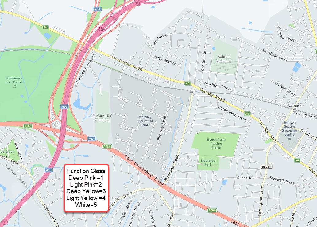
The HERE database uses a hierarchy of what we call Function Classes to build the best routing. The FC are numbered 1-5 with 1 = Motorways or similar … 5 = smallest roads
FC1- Allows for high volume, maximum speed traffic movement between and through metropolitan areas. eg a Motorway
FC2- High volume, high speed traffic movement between and through cities. eg Dual-carriageways
FC3- High volume traffic movement at lower level of mobility. eg A Roads
FC4- High volume traffic movement at moderate speed between neighbourhoods. These roads connect with higher functional class roads to collect and distribute traffic between neighbourhoods. eg B Roads
FC5- Local and neighbourhood streets eg unclassified roads
This is flexible and a motorway could be a FC3 road if it heads to a non-strategic town for example. Motorways show Deep Pink no matter what FC they are except connecting ramps and slip roads
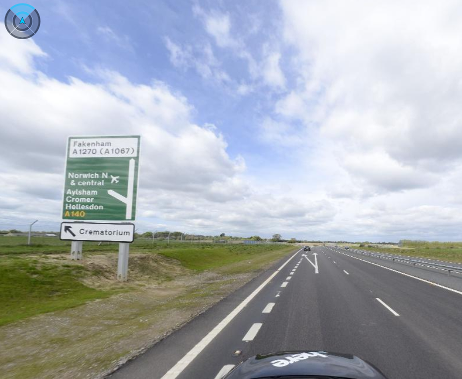
The Function Class of the new A1270 was assessed prior to opening, and it was decided to be FC2 from the A47 to the A140 junction and FC3 after that toward Fakenham. This is backed up by video from the site showing a ‘non primary road’ white sign for the rest fo the A1270 in the attached image.
Sorry for goign on! Thanks,
Ben
Jim Hamshaw • March 1, 2019 at 6:11 pm UTCHi Ben – understood thanks – doesn’t explain why the roundabouts are pink, though, and some segments around the A140/A1270 intersection go pink/yellow/pink again….. Also, does this affect speed calculations in Here navigation? (just curious as actual speeds/speed limits are no different all the way along the A1270)
Ben (HERE Moderator) • March 4, 2019 at 4:01 pm UTCHi jim
I think the different colours you see are in Map Creator and are approved or not approved state. Some edits may be automatically approved whilst others await a human approval. Thus you may see some endorsements or rejections as modeation teams get ot look at the changes. The ‘road type’ is a low prirority.Thanks, Ben
You must be logged in to reply to this topic.