-
 John Powell • February 27, 2018 at 6:01 am UTC
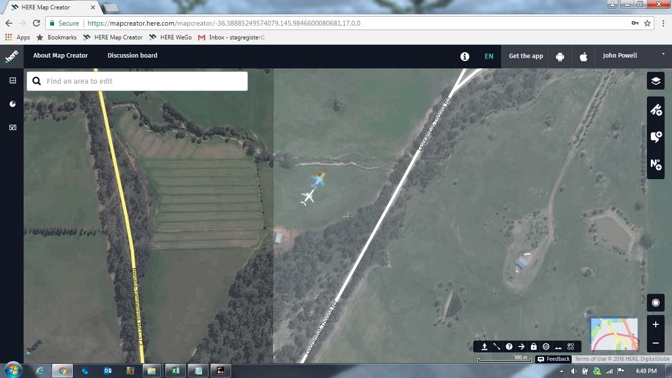
Here is an interesting image of an aircraft and a secondary image (halo, ghost whatever) taken near Benalla VIc.
1. What is the secondary image? Is it something the satellite creates? or weather? or just a distorted shadow.
2. I cannot work out the scaling as it appears to be close to the surface.
3. This image location is at least 200Km from the nearest airport Tullamarine and not on a regular flight path.
Any suggestions? Shona Chisholm • February 27, 2018 at 11:21 pm UTCHi John,
Most optical satellites like DigitalGlobe’s WorldView satellites have two separate cameras – one for high resolution B&W imagery, and a lower resolution Colour (Multi=spectral) Camera – for efficiency reasons, so the image files are much smaller to download from the satellite. eg. 50cm resolution B&W and 2m Multi. Then the two images are merged to produce a 50cm colour image.
You usually don’t notice the difference between B&W and colour with stationary objects but anything that’s moving quickly like aeroplanes will be slightly offset because of the timing difference between the two images being taken – which is really only split seconds. It means that the plane is definitely moving rather than just sitting in a field somewhere, but I’m not sure where it’s going? I guess a really keen plane spotter who’s good with numbers could calculate the height it’s travelling at based on the length of plane, distance it’s moved etc. etc
cheers, Shona
You must be logged in to reply to this topic.